| ©The Archaeological Settlements of Turkey - TAY Project | ||||||
|
|
||||||
Hanay Tepe |
||||||
|
|
||||||
| Ages | Maps | Photos | ||||
| EBA IA |
 |
 |
||||
|
|
||||||
|
Type:
|
Mound | |||||
|
Altitude:
|
92 m | |||||
|
Diameter:
|
m- Direction: | |||||
|
|
||||||
|
Region:
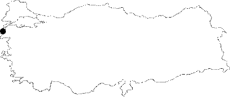
|
Marmara | |||||
|
Province:
|
Çanakkale | |||||
|
District:
|
Merkez | |||||
|
Village:
|
||||||
|
|
||||||
|
Destruction :
|
Other - Agriculture - Attention | |||||
|
|
||||||
|
TAYEx:
|
Visited - 22/6/2000 | |||||
|
|
||||||
|
Registration State:
|
Registered For detailed registration information please refer to Turkish pages. | |||||
 |
||||||
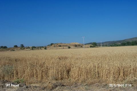
| Location: It lies north of the Kemerdere stream; a branch of the Kara Menderes on the eastern side of the Çanakkale- Ezine motorway; about 20 km north of Ezine; southeast of the Çanakkale Province. |
| Geography and Environment: It is located at the end of a ridge where the valley of Kermerdere opens into the Menderes Plain. The prehistoric finds are located on the southern slope of the settlement which was suggested to be the ancient city of Thymbra. Kemer stream flows to the south-southeast of the site. The road to Alexandreia Troas and Geyikli passes between the stream and the mound. On the northeastern section of the ridge that the settlement lies on are the facilities of TIGEM. The damage; even partly; still continues. |
| Destruction Details: The settlement was seriously damaged when TIGEM removed earth from the mound about 20 years ago [TAYEx 22.6.2000]. |