|
©The Archaeological Settlements of Turkey - TAY Project
|
|
|
|
|
|
Efeoglu |
|
|
For site maps and drawings please click on the picture... 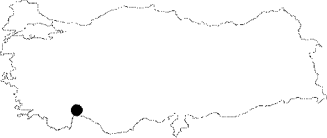 |
For photographs please click on the photo... 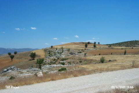 |
|
Type:
|
Mound |
|
Altitude:
|
880 m |
|
Region:
|
Mediterranean |
|
Province:
|
Antalya |
|
District:
|
Korkuteli |
|
Village:
|
Büyükköy |
|
Investigation Method:
|
Survey |
|
Period:
|
Ceramic |
|
|
|
 |
|
| Location: This mound site lies northwest of the city of Antalya; approximately 18 km northeast of the town of Kortukeli; 1 km southwest of the village of Büyüköy (also called "Büyük Ali Fahrettin Köy") and 250 m east of the Kürükini District. |
| Geography and Environment: The mound; known as Efeoglu; and in some publications as Asar; lies 40 m above the level of the plain and has a 150 m diameter. Durhasan Stream flows to the east of the mound. This stream may have functioned as a water source for the inhabitants of the site. |
| History: |
| Research and Excavation: The site was discovered by M.Özsait in 1993. |
| Stratigraphy: In addition to Late Neolithic-Early Chalcolithic sherds; the surface survey conducted on the mound yielded Late Chalcolithic; Iron Age and Roman ceramics [Özsait 1995:486]. |
| Small Finds: Pottery: Özsait notes that the ceramics were monochrome. The ware has not been well described. Ground Stone: Some grinding stones; which have not been assigned to a period; were collected from the surface. |
| Remains: |
| Interpretation and Dating: Like many sites in Göller Bölgesi (the Lakes Region); it is impossible to differentiate Late Neolithic and Early Chalcolithic ceramics in terms of ware and vessel forms. Therefore; this site can only skeptically be assigned to the Neolithic. |