| ©The Archaeological Settlements of Turkey - TAY Project | ||||||
|
|
||||||
Efeoglu |
||||||
|
|
||||||
| Ages | Maps | Photos | ||||
| Neolithic Chalcolithic IA |
 |
 |
||||
|
|
||||||
|
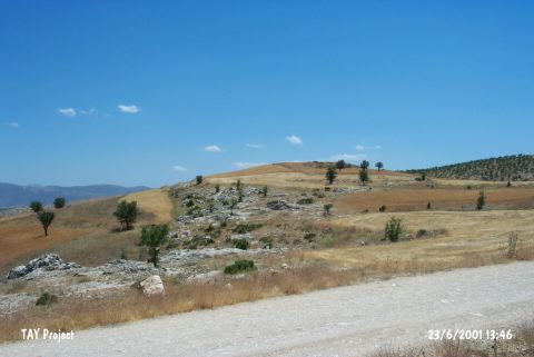
Type:
|
Mound | |||||
|
Altitude:
|
880 m | |||||
|
Diameter:
|
m- Direction: | |||||
|
|
||||||
|
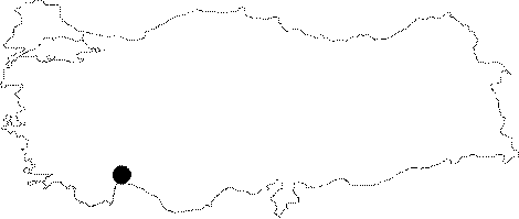
Region:
|
Mediterranean | |||||
|
Province:
|
Antalya | |||||
|
District:
|
Korkuteli | |||||
|
Village:
|
Büyükköy | |||||
|
|
||||||
|
Destruction :
|
Agriculture | |||||
|
|
||||||
|
TAYEx:
|
Visited - 23/6/2001 | |||||
|
|
||||||
|
Registration State:
|
For detailed registration information please refer to Turkish pages. | |||||
 |
||||||
| Location: This mound site lies northwest of the city of Antalya; approximately 18 km northeast of the town of Kortukeli; 1 km southwest of the village of Büyüköy (also called "Büyük Ali Fahrettin Köy") and 250 m east of the Kürükini District. |
| Geography and Environment: The mound; known as Efeoglu; and in some publications as Asar; lies 40 m above the level of the plain and has a 150 m diameter. Durhasan Stream flows to the east of the mound. This stream may have functioned as a water source for the inhabitants of the site. |
| Destruction Details: The mound is being damaged due to agricultural activities. Its surroundings are cultivated and east and northeast parts of the mound are plowed [TAYEx 23.6.2001]. |