|
©The Archaeological Settlements of Turkey - TAY Project
|
|
|
|
|
|
Seyitömer Höyük |
|
|
For site maps and drawings please click on the picture...  |
For photographs please click on the photo... 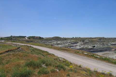 |
|
Type:
|
Mound |
|
Altitude:
|
1180 m |
|
Region:
|
Aegean |
|
Province:
|
Kütahya |
|
District:
|
Merkez |
|
Village:
|
Seyitömer |
|
Investigation Method:
|
Excavation |
|
Period:
|
Early Phrygian Middle Phrygian Late Phrygian |
|
|
|
 |
|
| Location: It is located within the territory of the Seyitömer Lignite Facilities; north of Seyitömer/Seydiömer Village; 24-25 km northwest of Kütahya Province as the crow flies. To the north of the mound are the lignite beds; to its east the factory and the Kütahya road. |
| Geography and Environment: The northern part of the mound is steep while the southern part is 20 m high and flat. The top hill is reported to measure ca. 200 square meters as a flat area [Aydin 1991:192]. The mound stands on a rocky clay strata called blue-green colored marn. Below this stratum lies a layer of lignite coal. The lignite opencast mine area, also including the mound is a pliocene aged lake formation. It consists of sedimentary rocks, conglomerates, clay layer in green and blue colors and a main coal seam. The composition of the coal seam ceiling is marl. The basin area was often subject to big scale tectonic movements. The topographic characteristics were almost lost due to constant removal of coal. The mound has an oval shape with an approximate height of 20 m. |
| History: The mound is located at the south of the area called ÔPhrygia Epictetus". It is known that this area is entirely under Persian hegemony during 5th and 4th centuries BC (until 334 BC). Based on this fact the settlement that was unearthed in the mound and was dated to 5-4th centuries BC was named Achaemenid Period Settlement [Bilgen et al. 2010:344]. |
| Research and Excavation: The salvage excavations started in 1989 under the direction of the Directorate of Eskisehir Archaeological Museum, and continued under the direction of the Directorate of Afyon Archaeological Museum between 1990-1993. Excavations at the mound started again under the directory of A.N. Bilgen from Dumlupinar University in 2006 and were carried out until 2014. It takes place in the registered archaeological sites list prepared by Ministry of Culture and Tourism. |
| Stratigraphy: During 2008 excavations following the work performed at level III it was found that this settlement contained two phases of architecture as 5th and 4th century [Bilgen et al. 2010:344]. |
| Small Finds: Architecture: The excavations on the northeastern slope reached down the Hellenistic Period and yielded plenty of of wooden logs, measuring 0.15-0.2 m in diameter at F, G, and H/14. Although these logs and heavily destroyed foundations do not reflect any certain architectural features, they indicate presence of a Phrygian architecture. Architectural remains from two phases of 5th century BC that were revealed in 2008 consists of a stairway located on the north slope of the mound, houses and silos. Houses and silos of similar characteristics of 5th century settlement were encountered in 4th century settlement. In addition to these a city wall was built encompassing the upper platform of the mound during 4th century. The wall thickness differs between 2-3 m and was supported by four towers. The city wall covers the 5th century houses. Besides these the stairway was covered during wall construction and its function as a stairway was ended. Architectural characteristics of both phases are similar. The houses are square or rectangular planned and usually contain a single room. But, there are also 2-3 room specimens as well. The building material used in the construction consist of debris stones, yellow clay soil commonly found in the region and wood. Wooden beam erecting holes were identified on the walls. The preserved parts of the walls are usually on one side. The houses in general contain a hearth and partitions. Silos are round planned. Their internal surfacesand bottoms are plastered with clay [Bilgen et al. 2010:343-344]. In 2010 excavation was conducted in the fortification wall 2, the terrace- fortification wall 5 and the terrace wall 6. The backside of the fortification wall 2 with a thickness of 2.10 m and a length of 48.09 m was filled with earth. The wall was bevelled by sliding each stones of the wall towards inside. The wall numbered 5 was preserved up to a length of 7.40 m and a thickness of 1.10 m. The wall was formed with large stone blocks and it extends in the northeast-southwest direction. It has been suggested that this wall could be the continuation of the wall numbered 2 based on its axis and stonemasonry. The wall numbered 6 is 5 m long and 0.25 m thick. The traces of plaster can be seen on its front face [Bilgen et al. 2012:235-236]. Pottery: 2 Phrygian, a narrow and a wide mouth jars were found underneath the stone covered floor of the Hellenistic period upper terrace walls during Northwest slope excavations [Ilasli 1996:res. 3]. The most important group of sherds during 2008 excavations are Attica produced imported material. Besides these; Achaemenid bowls, sherds containing Greek and Phrygian inscription, locally produced grey pottery which are imitations of Attica forms, commercial amphorae, oillamps [Bilgen et al. 2010:344-345]. Clay: Terra cotta spindl whorls and loom weights were found during 2008 excavations [Bilgen et al. 2010:345]. Mineral: A 1st Millennium BC crater sherd with bird figure decorated panel [Ilasli 1996:res. 13] which is similar to 7-8th century BC craters and a bronze fibula were found underneath the large building foundations of the upper mound level during west slope excavations. Animal remains: Dog bones were found inside two Phrygian vessel sherds underneath the Hellenistic Period stone floor covers of upper terrace walls during northwest slope excavatiosn [Ilasli 1996:res. 3]. Other: G/14 yielded two bullae; one with a gryphon and the other with a Persian war scene depiction [Ilasli 1996:pic. 5]. |
| Remains: |
| Interpretation and Dating: |