|
©The Archaeological Settlements of Turkey - TAY Project
|
|
|
|
|
|
Tell Mahmutlu / Koyuncu |
|
|
For site maps and drawings please click on the picture...  |
For photographs please click on the photo... 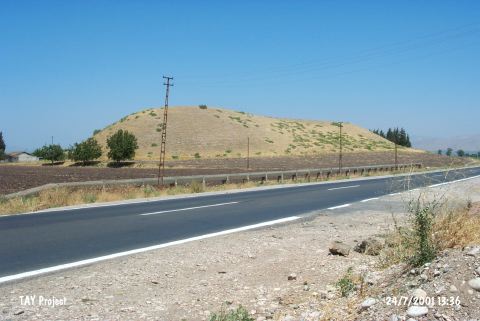 |
|
Type:
|
Mound |
|
Altitude:
|
110 m |
|
Region:
|
Mediterranean |
|
Province:
|
Hatay |
|
District:
|
Kirikhan |
|
Village:
|
Mahmutlu |
|
Investigation Method:
|
Survey |
|
Period:
|
|
|
|
|
 |
|
| It is situated to the north of the road from Kirikhan to Muratpasa, 3 km east of Kirikhan, northeast of Hatay. It is also known as Koyuncu. Based on the material collected from the surface by R. Braidwood, it is suggested to contain EBA and Iron Age settlements [Braidwood 1937:21]. It takes place in the registered archaeological sites list prepared by Ministry of Culture and Tourism. |
| Location: |
| Geography and Environment: |
| History: |
| Research and Excavation: |
| Stratigraphy: |
| Small Finds: |
| Remains: |
| Interpretation and Dating: |