| ©The Archaeological Settlements of Turkey - TAY Project | ||||||
|
|
||||||
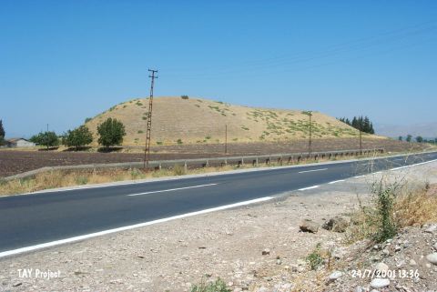
Tell Mahmutlu / Koyuncu |
||||||
|
|
||||||
| Ages | Maps | Photos | ||||
| EBA IA |
 |
 |
||||
|
|
||||||
|
Type:
|
Mound | |||||
|
Altitude:
|
110 m | |||||
|
Diameter:
|
m- Direction: | |||||
|
|
||||||
|
Region:
|
Mediterranean | |||||
|
Province:
|
Hatay | |||||
|
District:
|
Kirikhan | |||||
|
Village:
|
Mahmutlu | |||||
|
|
||||||
|
Destruction :
|
Illicit Digging - Agriculture | |||||
|
|
||||||
|
TAYEx:
|
Visited - 24/7/2001 | |||||
|
|
||||||
|
Registration State:
|
Registered For detailed registration information please refer to Turkish pages. | |||||
 |
||||||
| Location: |
| Geography and Environment: |
| Destruction Details: The mound has been damaged due to agricultural activities. Soil has been removed from its northern section. There is a pit of illicit digging on northeast slope. Starting from the skirts the surrounding territory of the mound is cultivated [TAYEx 24.7.2001]. |