|
©The Archaeological Settlements of Turkey - TAY Project
|
|
|
|
|
|
Müslümantepe |
|
|
For site maps and drawings please click on the picture...  |
For photographs please click on the photo... 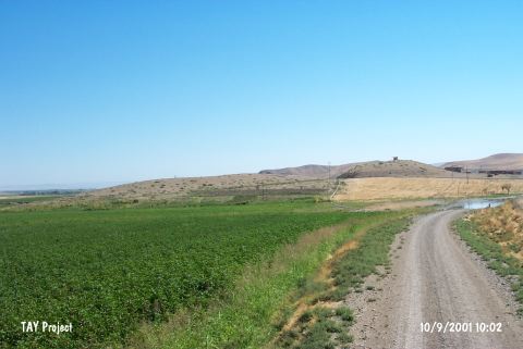 |
|
Type:
|
Mound |
|
Altitude:
|
480 m |
|
Region:
|
Southeastern Anatolia |
|
Province:
|
Diyarbakir |
|
District:
|
Bismil |
|
Village:
|
Sahintepe |
|
Investigation Method:
|
Excavation |
|
Period:
|
Early Iron Age |
|
|
|
 |
|
| Location: The site is located to the north of Sahintepe (Till Sahn) village in the district of Bismil in Diyarbakir province. |
| Geography and Environment: The mound is on a promontory projecting into the valley floor on the south bank of Tigris; separated from the mainland by a natural rocky outcrop with the appearance of a peninsula extending into the valley to its south. To the north and west it is bounded by Tigris; and to the east by Çölemezri Dere; which flows from the south and empties into Tigris after skirting the mound. The modern village begins from the southeastern slope of the hill. |
| History: |
| Research and Excavation: Müslümantepe was first visited by G. Algaze and his team during the survey of the Upper Tigris River Valley [Algaze et al. 1991:175-240]. Recent surveys were carried out and published by a team under the direction of E. Ay in 1999-2000 within the framework of the METU-TAÇDAM Project, and the excavations were initiated in 2001 [Ay 2002b:491]. The excavations were taken over by the General Directorate of Cultural Heritage and Museums of Turkey in 2005. The studies are carried out in three areas: Müslümantepe, Hõristiyantepe and the graveyard [Ay et al. 2013:273]. The trenches named S, T, U, V, and Y are located in Müslümantepe; the trenches named DD, EE, FF, GG, HH, JJ, KK, LL, MM, NN, OO, and PP are in Hõristiyantepe and the trenches named C, D, E, F and G are in the graveyard. It takes place in the registered archaeological sites list prepared by Ministry of Culture and Tourism. |
| Stratigraphy: It appears that Müslümantepe was an important site as it was located in a transition area between the plain cultures of North Mesopotamia and mountain cultures of East Anatolia during several periods in addition to having a strategical location. Samples of Late Uruk, Nineveh 5, Metalic ware, Middle and Late Bronze Ages and Early Iron Age ceramics were collected from the surface [Ay 2001:695-696]. The graves uncovered during excavations provided evidence for the presence of a strong Early Bronze Age settlement at Müslümantepe. Architectural remains, which were unearthed in the cemetery area, probably dating to an earlier period than the graves indicate that Müslümantepe had also a large expansion area during the Chalcolithic Age [Ay 2004:377]. Apart from the cone of the mound that is preserved up to date, the settlement covers an area of 20 hectares. However, the northern section of the mound was entirely damaged due to soil removal and floods. During the studies conducted in the field near Tigris River, about 60 m north of the cone of the mound, a cultural layer of about 2 m thick was revealed. The human remains found during the agricultural activities in the surrounding area show that the 2nd millennium BC and Late IA Müslümantepe spread over a large area. It is believed that the layers belonging to Late IA and later periods remained under the modern village settlement. The foundation excavations and sounding studies also support this argument [Ay et al. 2013:274]. In Hõristiyantepe, a stepped trench was opened in the northwest corner of the mound in order to understand the stratigraphic development in 2005. The potsherds dated to Ubaid Period were found in Trench DD 11 [Ay et al. 2013:277-8]. |
| Small Finds: Architecture: The grave pits uncovered at trench A1/21 of Müslümantepe were dug into the stone foundation and its underlying blocking belonging to the building level with no certain architectural integrity. The deposit of this level yielded abundant number of Neo Assyrian sherds. Deeper excavations conducted after evaluation and removal of the graves revealed nature of the blocking disturbed by the graves more prominently. Trench A1/21 yielded an open area stiffened with mud mortar in front of the entrance of the blocking. This open area allows access to a building with blocking floor and stone foundation. It is a rectangular structure oriented in east-west in trench A1/21 and B1/21. The access is from the northern end of the west (short) wall. A baking oven uncovered here facilitates understanding nature of the structure. Located right accross the entrance, the oven leans on the northern (long) wall of the structure. The southeastern corner of its stone foundation extends to the edge of the trench B1/21, probably leaning onto the foundation of a building complex [Ay 2002b:493]. The structure with blocking foundation uncovered at Müslümantepe as being destroyed by the Medieval graves bears architectural characteristics of the Neo Assyrian Period [Ay 2002b:497]. During the excavations conducted in the years between 2005 and 2008 in the trenches of S and T 42-43, a building complex with stone foundation, extending in the northwest-southeast direction, was exposed. It is determined that this building continues towards the Trench U, V 43. The potsherds collected from the building, which contains a high density of hearth remains, are dated to the Middle Assyrian Period. A stone paved courtyard was exposed in the north of the building. It is believed that this complex was used as a workshop [Ay et al. 2013:275]. A building complex surrounded by a revetment wall (rampart?) with mudbrick body was exposed during the excavations conducted in the trenches of KK 18-19, LL 18-21, and MM 18-21 in 2006 and 2007. The studies carried out in the trenches of NN 20-21, OO 20-21, and PP 21-22 in order to determine the east and south extensions of this complex in 2008. The workshops dated to the 1st millennium BC were found. The workshops constitute oven floors used for metal melting activities. Near the workshops, the postholes possibly belonging to temporary structures were found. It is believed that this area was used for seasonal activities [Ay et al. 2013:278]. Pottery: Based on the surface surveys conducted on the mound in 2000, it is suggested that Müslümantepe may play an important role in clarifying cultural history of the Upper Tigris Valley during the Assyrian Imperial Period, Ur Dynasty Period and Late Uruk Period. The excavations on the hilltop yielded abundant number of Neo Assyrian pottery among the deposit of the first layer [Ay 2002a:415-422]. |
| Remains: |
| Interpretation and Dating: It appears that Müslümantepe was an important site as it was located in a transition area between the plain cultures of North Mesopotamia and mountain cultures of East Anatolia during several periods as well as its strategical location. Müslümantepe and neighbouring centers between Amedi (Diyarbakir) and Hisn-i Keyfa (Hasankeyf) witnessed struggle of dominance between the Artuqid Dynasty and Armenian Kingdom and the County of Edessa during the 11th and 12th centuries in the Middle Age. During the Byzantine Period, the region was an issue of border conflict along the Tigris River between the Byzantine and Sassanid Empires due to its strategical location. The border dispute along the Tigris River was inherited from the earlier period of the Roman-Parthian Empires. Following the battles of Gaugamala and Arbela and fall of the Persian Empire, the Upper Tigris Valley fell into hands of Alexander the Great first, and then of Seleucids, and remained as a subject of border dispute throughout all these periods. It is believed that Müslümantepe as located on the northern border of the Assyrian Empire should have been a significant opponent during the disputes between the Akkadians on the south and the mountain people on the north. It represented the Sumerian culture on the north during the Ur Dynasty Period and Late Uruk Period [Ay 2002a:415]. |