|
©The Archaeological Settlements of Turkey - TAY Project
|
|
|
|
|
|
Erbaba |
|
|
For site maps and drawings please click on the picture...  |
For photographs please click on the photo... 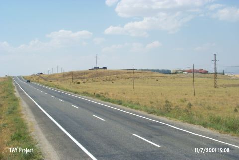 |
|
Type:
|
Mound |
|
Altitude:
|
1105 m |
|
Region:
|
Mediterranean |
|
Province:
|
Konya |
|
District:
|
Beysehir |
|
Village:
|
Gölkasi |
|
Investigation Method:
|
Excavation |
|
Period:
|
Ceramic |
|
|
|
 |
|
| Location: This site lies west of the city of Konya; 10 km north-northwest of the town of Beysehir; 2.5 km northeast of the village of Gölkasi (Kistifan) and east of the highway between Beysehir and Isparta. |
| Geography and Environment: The mound; which is reported to have a 4 m high cultural depositional fill layer with a 80 m diameter; lies 1.5 km east of Beysehir Lake; on a natural hillock. Part of the mound has been damaged by large hollows created by villagers who made use of the mound-soil. Plastering of the walls and floors can be seen in the cross-section of the largest of these hollows which is 40x4x2.5 m in size. |
| History: |
| Research and Excavation: This mound; discovered in 1963 during the surface survey conducted in the region around the Beysehir and Sugla Lakes by R. Solecki; was published as "Site 9; the mound north of Beysehir Lake" [Solecki 1965:132; 141]. Excavations on this mound were conducted in 1969; 1971; 1974 and 1977 under the direction of J. Bordaz. The extensive excavation; covering 1;100 square meters; exposed 22% of the mound. The mound stratigraphy was determined; as a result of these excavations. A large Neolithic architectural complex was also discovered. It takes place in the registered archaeological sites list prepared by Ministry of Culture and Tourism. |
| Stratigraphy: It has been reported that there are a total of three cultural depositional layers in this mound. The entire mound; with the exception of a few Late Chalcolithic sherds resembling Hacilar painted pottery found on the surface; is Late Neolithic in date. The layers from top to bottom are as follows: Layer I: This layer; which varies between 60-100 cm in thickness; is composed of a losely packed; grayish; sandy soil. Layer II: This layer; which is 80 cm in thickness; is more compacted than Layer I. The soil is still gray in color and sandy but the sand is coarser in composition. Layer III: The soil characteristics of this layer; which drastically varies in thickness between 100 and 250 cm; resemble Layer II. The soil is darker brown. Excavations revealed many burnt patches. Virgin Soil: No cultural remains were found in this yellowish; sandy; calcaerous sterile layer. Excavations six meters from the surface of the mound reached a layer composed of the hard-shells of fresh-water mollusks; indicating that the area was once a fresh water lake. It may also have been an earlier phase of Beysehir Lake. |
| Small Finds: Architecture: The best preserved architectural occupational phases were found in the uppermost Layer I. This layer yielded several rows of cell planned rectangular houses facing northeast. In addition to having small rooms; the houses appear to have been constructed with buttressing to support the ceiling. These structures were built with irregular limestone blocks held together with mud-mortar. The foundations are comprised of larger stones and are constructed in the same manner. The lower stones appear to be chosen and lined with care and are more regular in shape. The thickness of the walls which have been preserved up to a height of 1 m is 60 cm. Some of the rooms have gray plastering on the floor. The construction technique is the same in all three layers although the floor plastering of the third layer is red in color. No doorways were found with the exception of one of the structures in the latest occupational phase suggesting that the houses had entrances from the roofs. The limestone blocks used in the construction of the houses of the inhabitants of Erbaba were obtained from the rock quarry 500 m southwest of the site. Pottery: The analysis over 32;000 sherds revealed that two main types of wares were used. In the upper layers the ware named "Gastropod Ware" by J. Bordaz included gastropod tempering. This ware; which can be red; brown or yellowish gray in surface color; has been well described in site publications. Closed forms are common while flat bottomed; crescent-shaped vessels; high forms and vessels with lugs can be found. The ware of the lower levels; on the other hand; has mica; sand and grit tempering and has thus been called "Fine Grit Tempered Ware". The surface color of this burnished ware is black or brown. The vessel shapes and forms are the same although the lugs differ. The lugs from the ware of the lower levels are pierced. Three different types of ceramics were discovered within the the sherds revealed at Erbaba. According to their cultural sequence and in accordance with the classical terminology these were identified as "Early, Mid and Late Tradition". This sequence is the similar of Çatalhöyük and Suberde [Özdöl 2008:377]. Clay Finds: A few human figurines were found among the baked clay finds. One of them is a 2 cm long woman figurine; found whole. Another is a male figurine portrayed in sitting position. A cylindrically-shaped head of a man with a beard which functioned as a pendant was also found. Chipped Stone: The flint necessary for the chipped stone tool production of Erbaba must have been brought from the mountains west of Beysehir Lake; while the obsidian probably came from east of the Konya Plain; from the Aksaray Region. Flint was used in the production of larger and heavier tools and especially for scrapers. Obsidian was preferred for non-retouched blades and flakes. Points; sickle blades; notched and denticulated blades; end and side scrapers; perforators and burins are among the used tools. Points are rare while sickle blades comprise 15% of the chipped stone production. This suggests that agriculture was of much importance. Ground Stone: In addition to pounding stones; polishing stones; hammering and grinding stones; some small; slipped; celts made from serpentine have been found. Fauna: Large quantities of faunal remains were found both intra and extra-murally. The analysis of the sheep; goat and cattle bones confirms that the inhabitants of Erbaba had domesticated these animals. Wild-pig; deer; bird and fish are rare. Flora: It has been determined that Emmer wheat; Einkorn; durum wheat; barley; lentils and peas were cultivated. |
| Remains: |
| Interpretation and Dating: The finds from Erbaba were assigned to the Neolithic after comparison with material from other contemporaneous sites. Bordaz thus believes that the upper layers of Erbaba are contemporaneous with Hacilar IX-VII while the lower levels; in terms of finds; resemble Çatalhöyük VII-VI. More specifically; the site is assigned to Çatahöyük VI and Hacilar IX. The only 14C date for the site reads (uncalibrated) 5;780±120 BC [Todd 1980:149]. Esin does not believe that Erbaba has achieved as much in agricultural production as Çatalhöyük has [Esin 1981:62-63]. The 14C data on the earliest level III is more in number compared to levels II and I above, and it is considered dependable. On level III the date read is approximately between 6600-6400 BC, the end of the settlement was dated to approximately 6000 BC [Özdöl 2008:376]. |