| ©The Archaeological Settlements of Turkey - TAY Project | ||||||
|
|
||||||
Ibonun Rampasi |
||||||
|
|
||||||
| Ages | Maps | Photos | ||||
| Palaeolithic/Epipalaeolithic |
 |
 |
||||
|
|
||||||
|
Type:
|
Habitation Site / Workshop | |||||
|
Altitude:
|
50 m | |||||
|
Diameter:
|
m- Direction: | |||||
|
|
||||||
|
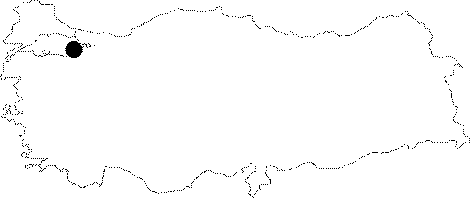
Region:
|
Marmara | |||||
|
Province:
|
Yalova | |||||
|
District:
|
Merkez | |||||
|
Village:
|
Akköy | |||||
|
|
||||||
|
Destruction :
|
Highways, roads, bridges etc. | |||||
|
|
||||||
|
TAYEx:
|
Visited - 18/7/2000 | |||||
|
|
||||||
|
Registration State:
|
For detailed registration information please refer to Turkish pages. | |||||
 |
||||||
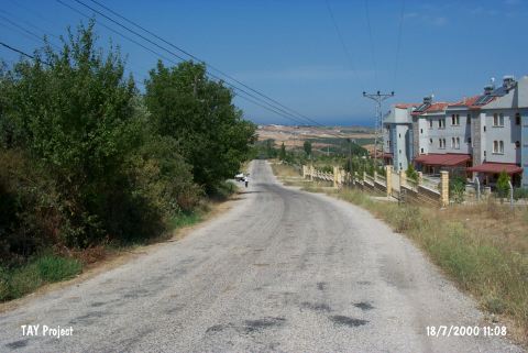
| Location: This site lies on the southern shore of the Sea of Marmara in the province of Yalova between the center of the town and the summer resort village of Çinarik. It is about 1 km inland from the sea and about 4 km from Çinarcik. |
| Geography and Environment: The site is composed of a scattered collection of tools spread over a large 100x150 m area; on both sides of the sloping sharp bend in the road going from Yalova to Çinarcik via the village of Samali. The site has been called "Ibonun Rampasi" after the local name for this bend in the road. |
| Destruction Details: The road between Koruköy and Akköy villages; which is locally known as Ibo'nun Rampasi; passes from the middle of the findspot [TAYEx 18.7.2000]. |