| ©The Archaeological Settlements of Turkey - TAY Project | ||||||
|
|
||||||
Prostanna |
||||||
|
|
||||||
| Ages | Maps | Photos | ||||
| Greek-Roman |
 |
 |
||||
|
|
||||||
|
Type:
|
City | |||||
|
Altitude:
|
m | |||||
|
Diameter:
|
m- Direction: | |||||
|
|
||||||
|
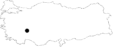
Region:
|
Mediterranean | |||||
|
Province:
|
Isparta | |||||
|
District:
|
Egirdir | |||||
|
Village:
|
Sevinçbey | |||||
|
|
||||||
|
|
||||||
|
|
||||||
|
TAYEx:
|
- | |||||
|
|
||||||
|
Registration State:
|
Registered For detailed registration information please refer to Turkish pages. | |||||
 |
||||||
| Location: The ancient city of Prostanna lies on a narrow land combining the Davras Mountain with the hill to the northeast on the southwestern end of the Egirdir Lake; and it is mainly situated to the south and southwest of the hill. Ptolemy refers to the city as Prostama [Ptolemy 5; 5; 7]. It was placed between the ancient cities of Tymbriada and Konana in the list of Hierocles [Hierokles 674; 1]. |
| Geography and Environment: |
| Destruction Details: |