| ©The Archaeological Settlements of Turkey - TAY Project | ||||||
|
|
||||||
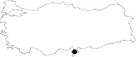
Altinözü |
||||||
|
|
||||||
| Ages | Maps | Photos | ||||
| Palaeolithic/Epipalaeolithic |
 |
 |
||||
|
|
||||||
|
Type:
|
Single Findspot | |||||
|
Altitude:
|
m | |||||
|
Diameter:
|
m- Direction: | |||||
|
|
||||||
|
Region:
|
Mediterranean | |||||
|
Province:
|
Hatay | |||||
|
District:
|
Altinözü | |||||
|
Village:
|
Merkez | |||||
|
|
||||||
|
|
||||||
|
|
||||||
|
TAYEx:
|
- | |||||
|
|
||||||
|
Registration State:
|
For detailed registration information please refer to Turkish pages. | |||||
 |
||||||
| Location: This site is 12 km southeast of the city of Antakya close to the town of Altinözü. It extends over a large area southeast of this town which includes the upper terrace and the field it overlooks as well as the western bank of a small branch of the Asi River which lies east of the town. |
| Geography and Environment: Low undulating hills are characteristic of this area. No further information is supplied on the geographical positioning of this site. |
| Destruction Details: |