| ©The Archaeological Settlements of Turkey - TAY Project | ||||||
|
|
||||||
Tell Dhahab / Altintepe |
||||||
|
|
||||||
| Ages | Maps | Photos | ||||
| Neolithic EBA |
 |
 |
||||
|
|
||||||
|
Type:
|
Mound | |||||
|
Altitude:
|
220 m | |||||
|
Diameter:
|
m- Direction: | |||||
|
|
||||||
|
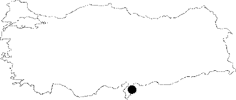
Region:
|
Mediterranean | |||||
|
Province:
|
Hatay | |||||
|
District:
|
Reyhanli | |||||
|
Village:
|
Merkez | |||||
|
|
||||||
|
Destruction :
|
Contemporary Settlements - Attention | |||||
|
|
||||||
|
TAYEx:
|
Visited - 16/7/2001 | |||||
|
|
||||||
|
Registration State:
|
For detailed registration information please refer to Turkish pages. | |||||
 |
||||||
| Location: The site lies southeast of the city of Antakya; 1.7 km southeast of the town of Reyhanli. |
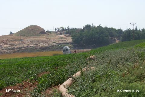
| Geography and Environment: It is a 10 m high round mound with a 200 m diameter. The mound; known as Tell Dhahab or Altintepe; lies in the Amuq Plain. South of the mound is military zone and to the north the site of Tell el Cüdeyde takes place. |
| Destruction Details: The western part of the mound has been completely vanished. Soil removed for motorway construction [TAYEx 16.7.2001]. |