| ©The Archaeological Settlements of Turkey - TAY Project | ||||||
|
|
||||||
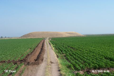
Tell Hasanusagi |
||||||
|
|
||||||
| Ages | Maps | Photos | ||||
| Neolithic EBA |
 |
 |
||||
|
|
||||||
|
Type:
|
Mound | |||||
|
Altitude:
|
180 m | |||||
|
Diameter:
|
m- Direction: | |||||
|
|
||||||
|
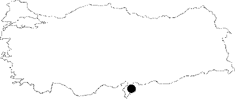
Region:
|
Mediterranean | |||||
|
Province:
|
Hatay | |||||
|
District:
|
Reyhanli | |||||
|
Village:
|
Hasanusagi | |||||
|
|
||||||
|
|
||||||
|
|
||||||
|
TAYEx:
|
Visited - 18/7/2001 | |||||
|
|
||||||
|
Registration State:
|
For detailed registration information please refer to Turkish pages. | |||||
 |
||||||
| Location: This site lies 26.5 km southeast of the city of Hatay; approximately 14 km west-northwest of the town of Reyhanli; between the villages of Hasanusagi and Ömercedit. 500 m north of the mound lies the site of Hasanusagi al Dai'ah. |
| Geography and Environment: Tell Hasanusagi; which lies in the Amuq Plain; east of Lake Antioch; is a high mound with stepped terraces. The dimensions of the mound have not been provided. It is surrounded by fertile land. There is a slight depression in the western part of the mound. It is believed that the lowest levels of this mound are beneath the modern plain level. The area around the mound became marshy in the rainy season in 1933 when the site was surveyed. It has not been reported whether there are any fresh water sources close to the site. The other name of the site is Yerkuyu. |
| Destruction Details: |