| ©The Archaeological Settlements of Turkey - TAY Project | ||||||
|
|
||||||
Karaz |
||||||
|
|
||||||
| Ages | Maps | Photos | ||||
| Chalcolithic EBA IA |
 |
 |
||||
|
|
||||||
|
Type:
|
Mound | |||||
|
Altitude:
|
1800 m | |||||
|
Diameter:
|
m- Direction: | |||||
|
|
||||||
|
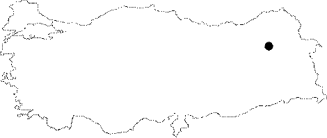
Region:
|
Eastern Anatolia | |||||
|
Province:
|
Erzurum | |||||
|
District:
|
Merkez | |||||
|
Village:
|
Karaz | |||||
|
|
||||||
|
Destruction :
|
Contemporary Settlements | |||||
|
|
||||||
|
TAYEx:
|
Visited - 27/6/2003 | |||||
|
|
||||||
|
Registration State:
|
Registered For detailed registration information please refer to Turkish pages. | |||||
 |
||||||
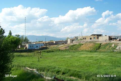
| Location: It is located to the village of Karaz (Karamanlar); 5 km north of the Ilica Sub-District; about 16 km west-northwest of the Erzurum Province [Kosay-Turfan 1959:349]. |
| Geography and Environment: It is a medium sized mound; 16 m in height and ca. 20 m in diameter. It has been completely obscured by the houses of the modern village [Kosay-Turfan 1959:map.2]. Southern part faces the plain irrigated by the Karasu Stream. It is surrounded by a fertile land suitable both for cropping and pasture. It has been severely damaged by the local villagers who removed soil and stones from the mound. Leaders of the excavation claim that no good results can be obtained from the upper levels. To the south lies another flat hill; probably consisting of remains of a late period which this exposes that the mound has more than one core. |
| Destruction Details: The mound lies beneath the modern village houses. Its soil was removed in order to use for the construction of these houses [TAYEx 27.6.2003]. |