| ©The Archaeological Settlements of Turkey - TAY Project | ||||||
|
|
||||||
Myus |
||||||
|
|
||||||
| Ages | Maps | Photos | ||||
| IA Greek-Roman |
 |
 |
||||
|
|
||||||
|
Type:
|
City | |||||
|
Altitude:
|
m | |||||
|
Diameter:
|
m- Direction: | |||||
|
|
||||||
|
Region:
|
Aegean | |||||
|
Province:
|
Aydin | |||||
|
District:
|
Söke | |||||
|
Village:
|
Avsar | |||||
|
|
||||||
|
|
||||||
|
|
||||||
|
TAYEx:
|
- | |||||
|
|
||||||
|
Registration State:
|
Registered For detailed registration information please refer to Turkish pages. | |||||
 |
||||||
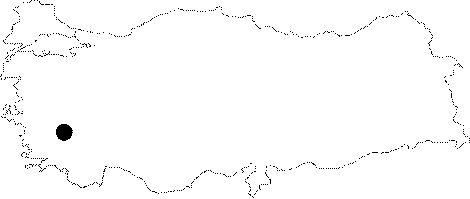
| Location: It is situated to the northwest of the Avsar Village; south of the Soke District of the Aydin Province. It is accessible after a two hours walk from the Avsar Village [Bean 1976:602]. Used to be a peninsula during the Ancient Period, Myus now lies 100 m south of the Meander River, 15 km northeast of Miletus. At present, it is called Avsar Kalesi. |
| Geography and Environment: The alluvions washed down by the Meander River blocked Myus' access to the sea [Bean 2001:225-226]. During the period of Strabo, Myus was located thirty stadion (800 m) off the shore, accessible only with small boats. The city consists of a small hill, inclining from south to north, which also include sacred monuments. On the lower slope of the hill there are two successive rocky terraces. It is known that during the Ancient Period a temple stood on each of these terraces. The main city with ruins of domestic structures and cisterns carved into the rocks lies to the northeast of the temple hill [Akurgal 2000:397-398]. |
| Destruction Details: |