| ©The Archaeological Settlements of Turkey - TAY Project | ||||||
|
|
||||||
Biris Mezarligi |
||||||
|
|
||||||
| Ages | Maps | Photos | ||||
| Palaeolithic/Epipalaeolithic Neolithic |
 |
 |
||||
|
|
||||||
|
Type:
|
Artifact Scatter | |||||
|
Altitude:
|
580 m | |||||
|
Diameter:
|
m- Direction: | |||||
|
|
||||||
|
Region:
|
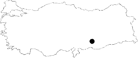
Southeastern Anatolia | |||||
|
Province:
|
Sanliurfa | |||||
|
District:
|
Bozova | |||||
|
Village:
|
Merkez | |||||
|
|
||||||
|
Destruction :
|
Agriculture | |||||
|
|
||||||
|
TAYEx:
|
Visited - 3/9/2001 | |||||
|
|
||||||
|
Registration State:
|
For detailed registration information please refer to Turkish pages. | |||||
 |
||||||
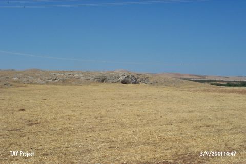
| Location: This site is located southwest of the site of Sanliurfa; approximately 2 km south of the town of Bozova; in the Küçük Gölbasi Region; and on the rocky plain west of an artificial lake/water reservoir. The site lies 4.5 km northwest of the village of Biris. The survey code of this site is U 51 / 1. |
| Geography and Environment: The mound on the rocky slope is 120x25 m in size and is currently used as the graveyard for the village of Biris; especially on the upper and eastern sides. One of the names of the site; Biris Mezarligi; literally means "the Biris graveyard". The site has also been referred to as Küçük Gölbasi. The graves have damaged part of the campsite/habitation area. Perhaps the most important reason in prehistory for selecting this site is because it is close to the spring; which is the current source of water which feeds the water reservoir (For further information see Harmankaya-Tanindi 1996:Biris Mezarligi). |
| Destruction Details: The site is being used for agriculture [TAYEx 3.9.2001]. |