| ©The Archaeological Settlements of Turkey - TAY Project | ||||||
|
|
||||||
Can Hasan 1 |
||||||
|
|
||||||
| Ages | Maps | Photos | ||||
| Neolithic Chalcolithic 14C |
 |
 |
||||
|
|
||||||
|
Type:
|
Mound | |||||
|
Altitude:
|
1140 m | |||||
|
Diameter:
|
115 m- Direction: NE-SW | |||||
|
|
||||||
|
Region:
|
Central Anatolia | |||||
|
Province:
|
Karaman | |||||
|
District:
|
Merkez | |||||
|
Village:
|
Alaçati | |||||
|
|
||||||
|
Destruction :
|
Contemporary Settlements | |||||
|
|
||||||
|
TAYEx:
|
Visited - 14/8/2002 | |||||
|
|
||||||
|
Registration State:
|
Registered For detailed registration information please refer to Turkish pages. | |||||
 |
||||||
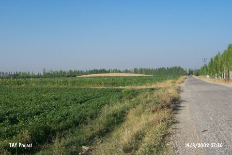
| Location: It lies about 750 m southeast of Can Hasan III; 12 km northwest of the province of Karaman. |
| Geography and Environment: The mounds Can Hasan I and III; which are at a close distance to the foothills of the Taurus and take place in a fertile plain; are prehistoric settlements. Can Hasan II is dated to the later periods [French 1962b:27]. Mound no I of can Hasan; which is known as Canasun in Kiepert and later as Canason; measures 360x280x5 m [French 1962a:36]. |
| Destruction Details: A dirt road passes on eastern part of the mound; the trenches are being used for garbage dumping. The mound has been encircled by barbed wire [TAYEx 14.8.2002]. |