| ©The Archaeological Settlements of Turkey - TAY Project | ||||||
|
|
||||||
Ulucak Höyük |
||||||
|
|
||||||
| Ages | Maps | Photos | ||||
| Neolithic Chalcolithic EBA 14C |
 |
 |
||||
|
|
||||||
|
Type:
|
Mound and Cemetery | |||||
|
Altitude:
|
220 m | |||||
|
Diameter:
|
m- Direction: | |||||
|
|
||||||
|
Region:
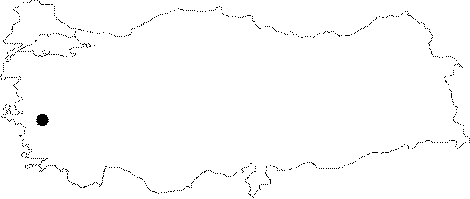
|
Aegean | |||||
|
Province:
|
Izmir | |||||
|
District:
|
Kemalpasa | |||||
|
Village:
|
Ulucak | |||||
|
|
||||||
|
Destruction :
|
Contemporary Settlements | |||||
|
|
||||||
|
TAYEx:
|
Visited - 14/9/2000 | |||||
|
|
||||||
|
Registration State:
|
Registered For detailed registration information please refer to Turkish pages. | |||||
 |
||||||
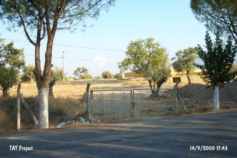
| Location: It lies 150 m north of the Bornova-Turgutlu-Ankara motorway at 15th km; 7 km northwest of Kemalpasa; east of the Bornova District and the Izmir Province. It is about 400 km north of the old Izmir-Kemalpasa road and 1 km south of Ulucak village. To the immediate south lies the tobacco factory of Socotap. The cemetery is located 150 m southeast of the mound in the garden of this factory [Derin-Özkan 1999:plan1]. The road parting from the motorway to the village of Ulucak passes by the west side of the hill. The cemetery is partly obscured by the motorway. |
| Geography and Environment: It is a round and flat mound located in a plain; 5 m in height and 90 m in diameter [French 1965b:18]. The settlement is suggested to measure larger. The southern and eastern parts of the hill have been partly damaged by the road and the environmental arrangement factories. The mound gets lower toward the north. The plain of Kemalpasa formed a fertile land around the mound by the accumulation of alluvial brought by the waters running from the high mountains in the vicinity. The plain is separated from the shore plain of Bornova by the threshold of Belkahve. The settlement is reported to be located on the natural transportation road between Central Anatolia and the Gulf. The mound is said to locate at the foothill of an old accumulated conic hill [Derin-Öner 1997:412]. The cemetery has been partly damaged during the construction of the factory. A small stream flows about 400 m south; parallel to the road. It is reported that the site was cultivated at during the researches. Together with the excavations; palaeogeographical investigations including the mound and its surroundings were also started under the leadership of I. Kayan from the Geography Department of Ege University; and it was understood that the mound once expanded over a much larger area. |
| Destruction Details: (Foto Contribution: Tan Erdem 1.2.2006) |